Performance and Accountability & Data Analytics
The GIS and Data Analytics Division promotes the use of technology with each department to provide the highest standard of services to our citizens. We utilize technology to integrate and streamline processes and report data that is critical for decisions in both normal operation and maintenance as well as emergency response.
GIS
The GIS Division manages the data of the Parish and maintains a GIS utilizing primarily ESRI Inc. Products. View our webmaps through online browser by clicking HERE. In 2016 our GIS Division won an ESRI Special Achievement in GIS award. (learn more)

The GIS division maintains and provides use of our webmaps as well as custom made maps and data packages. These can be ordered by submitting a Public Records Request Form and applicable attached fees.
- Brian Martinez, Director
- Chunyue Liu (Cynthia), GIS Analyst III
- Kib Prestridge, GIS Analyst II
Data Analytics
The APG GIS Division also coordinates with the technology department on software and data functions of the Parish. We integrate several systems within the Parish to produce useful products such as reports, dashboards, and data streaming. This includes GPS, Weather and Rainfall, Traffic, Work Order, Financial, and other systems for product and services.
 |  |
|
Click here to View the online map Gallery
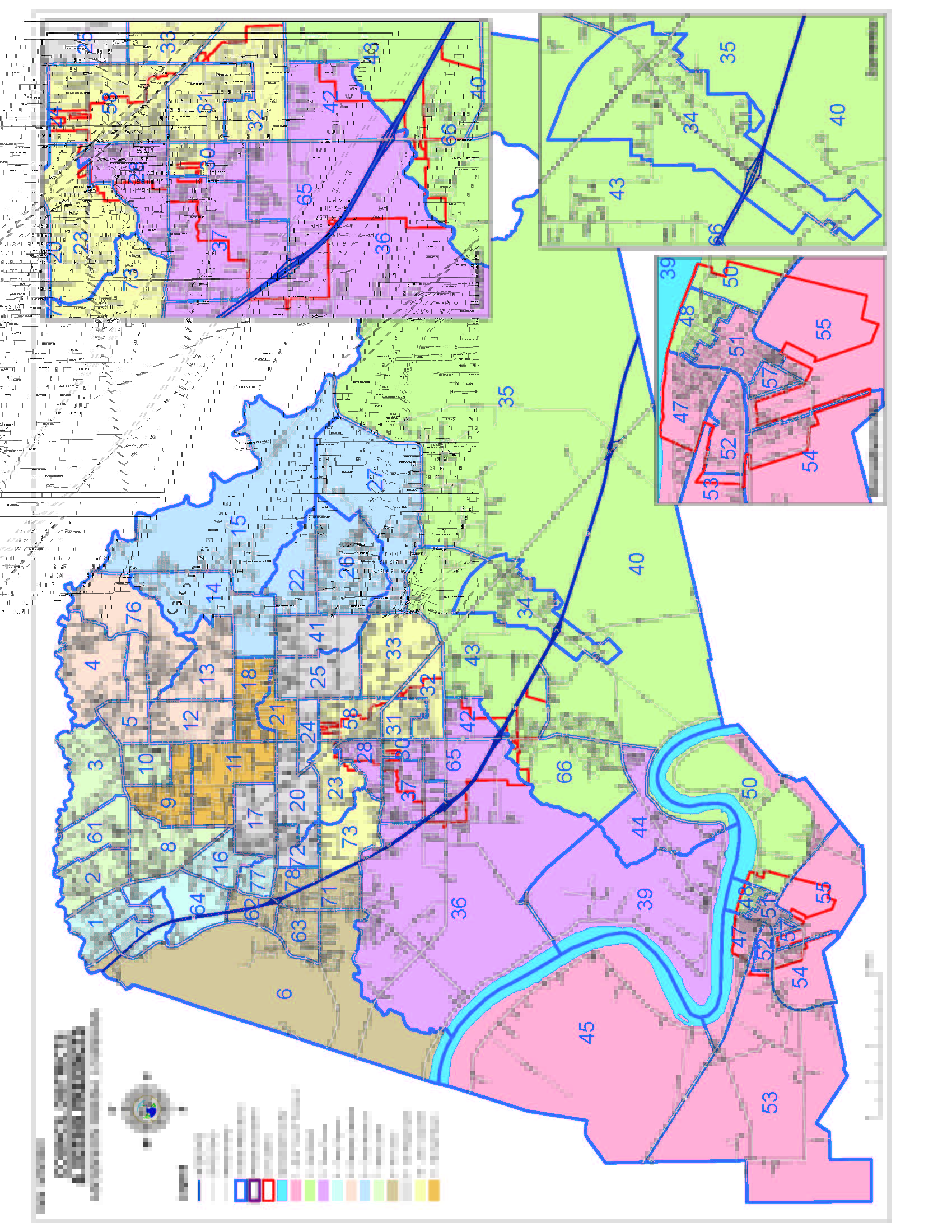
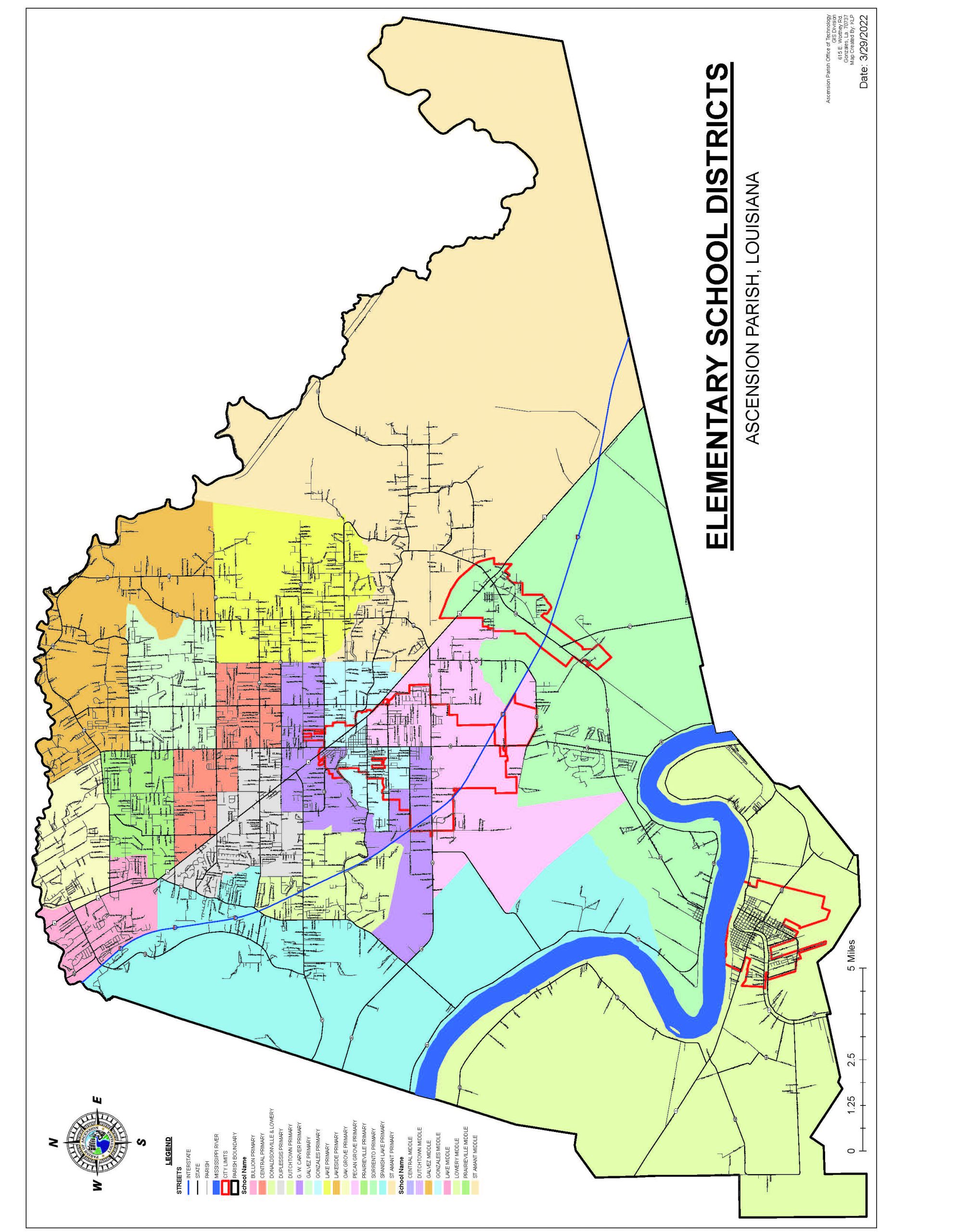
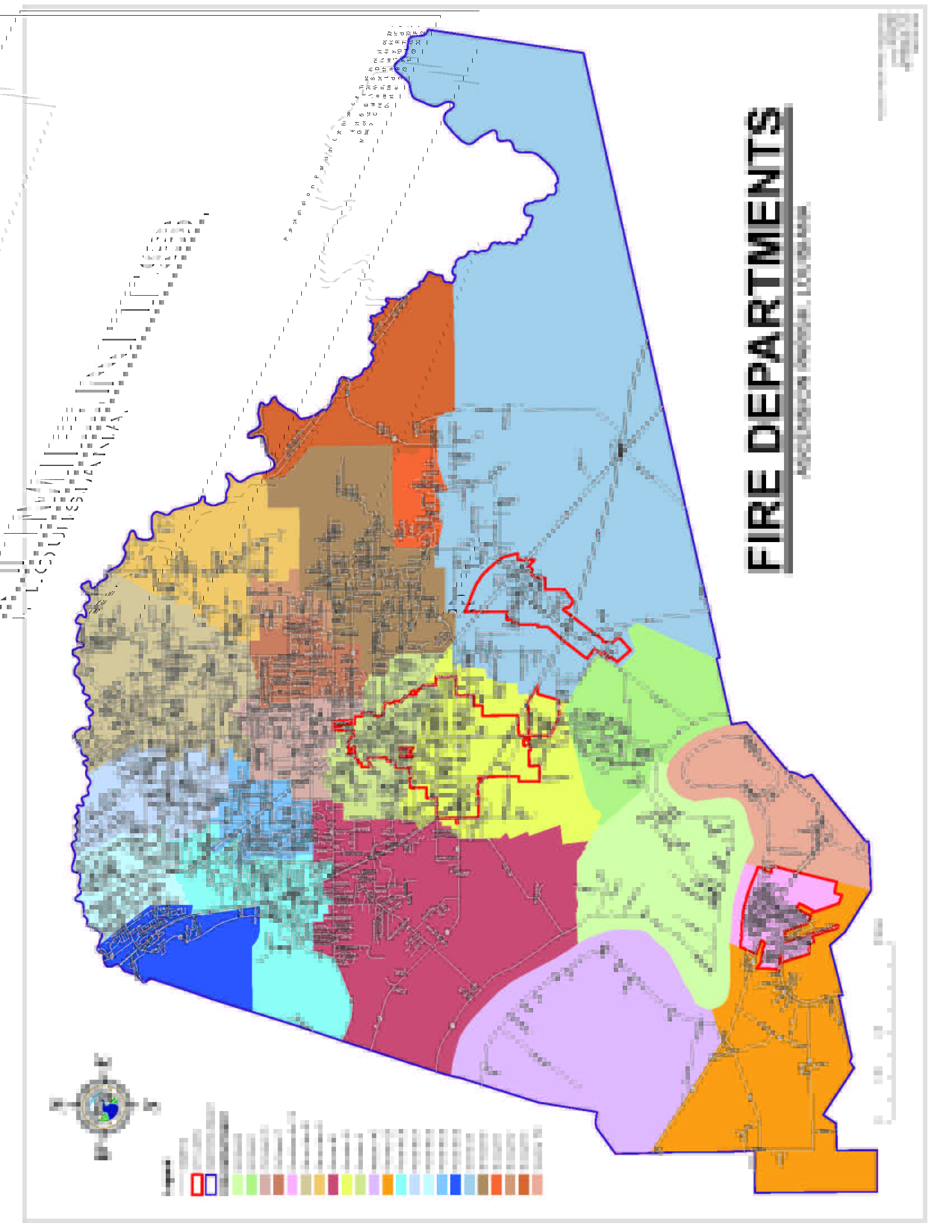
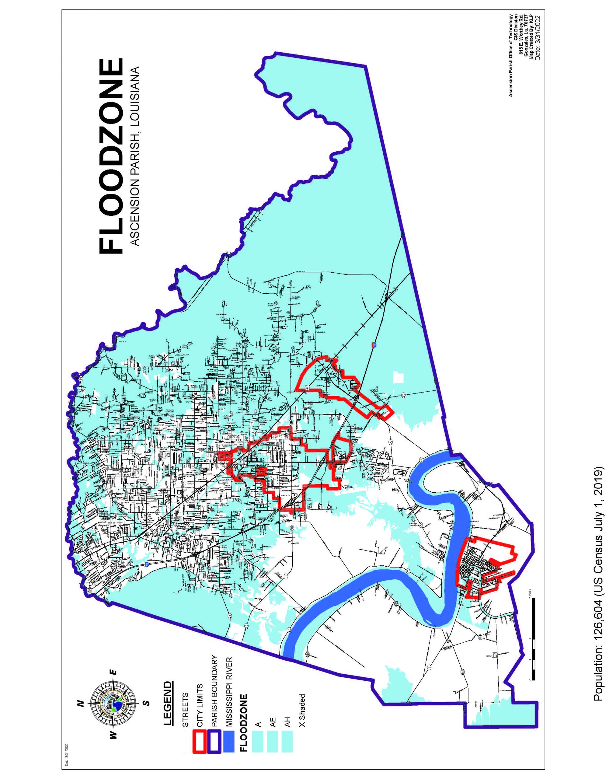
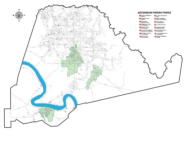
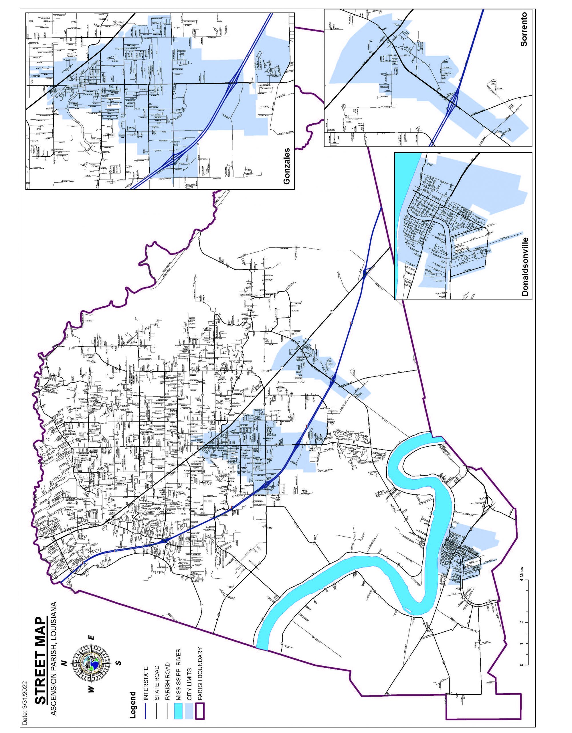
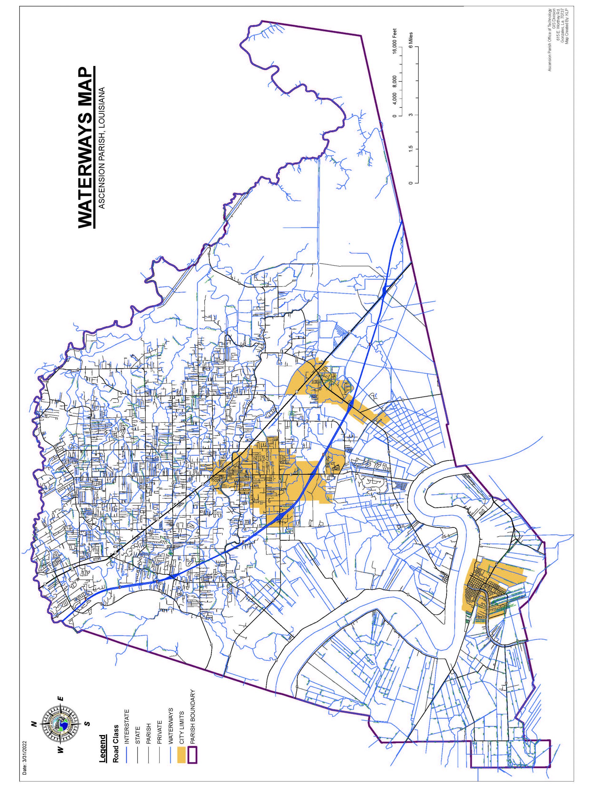
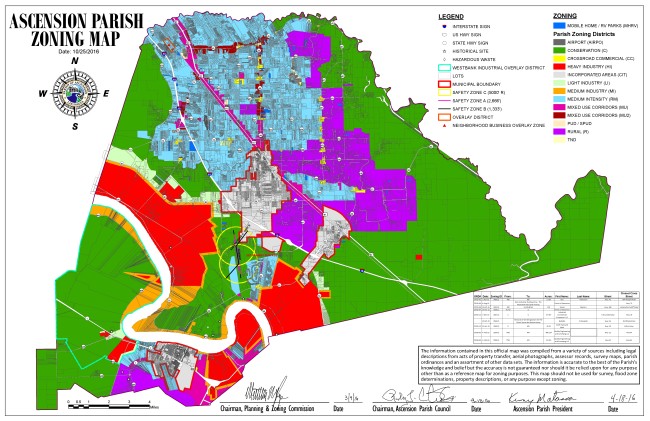
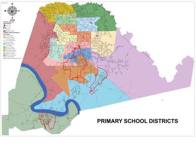
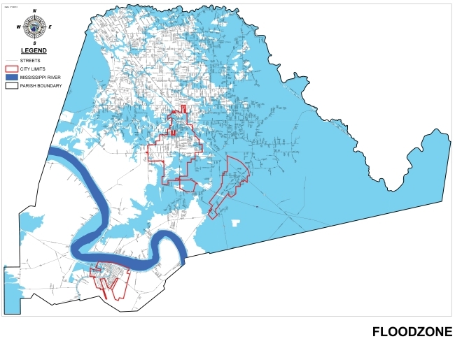
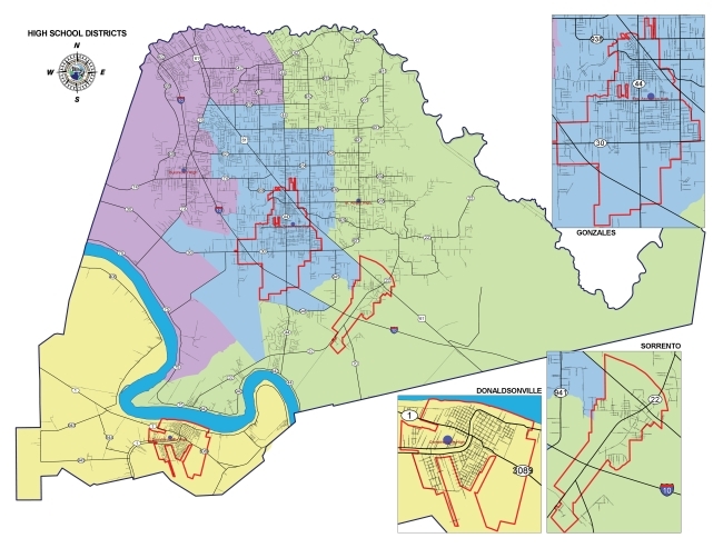
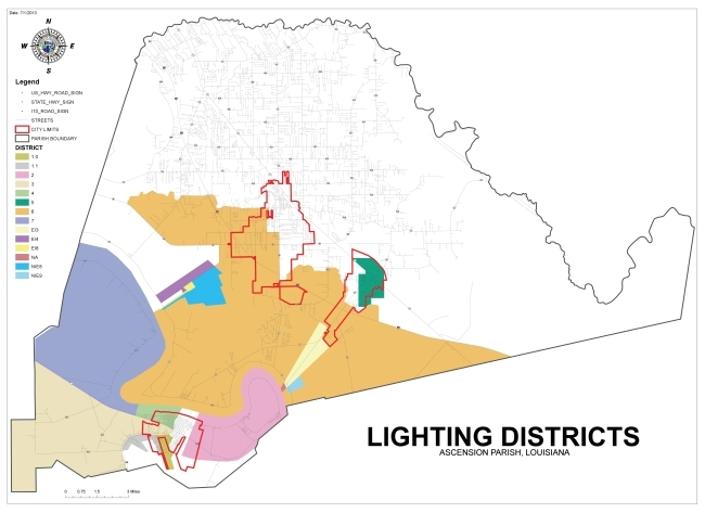
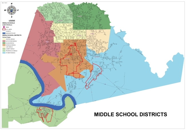
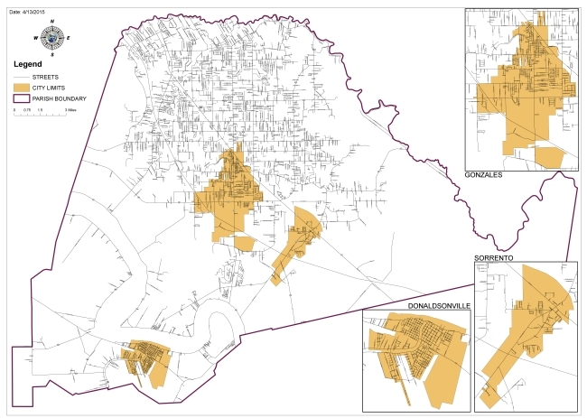
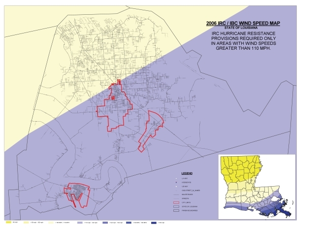
PDF Maps
Below you can view E size PDF copies of parish maps. Just navigate to the map you would like to view and click on it to see the full size PDF.
{imageshow sl=2 sc=2 /}
Note:
The information contained on this page has been compiled from the most accurate source data available from Ascension Parish, including legal descriptions from property acts of transfer, aerial photographs, assessor records, survey maps, parish ordinances and an assortment of other data sets. The information is accurate to the best of the Parish’s knowledge and belief, but the accuracy is not guaranteed. These maps are for reference purposes only and are not to be construed as a legal document or survey instrument. Any reliance on the information contained herein is at user’s own risk. Ascension Parish assumes no responsibility for any use of the information contained herein or any loss resulting therefrom. Any parcel data displayed is considered to be in draft form and the Property Assessor assumes no liability. This map should not be used for survey, flood zone determinations or any other purpose for which it was not intended.